Environmental Studies
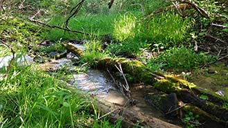
Wetland, surface water and stream field investigations and delineations have been completed within each project area. During the field investigations, scientists examined soils, vegetation, and hydrology. They documented wetlands, watercourses, and non-wetland characteristics on forms and mapping. Wetland and stream boundaries are delineated in the field. The mapping will help engineers avoid and minimize impacts to these features during the Preliminary Engineering and Final Design of each of the three projects.
The Project Team also conducted interviews with potential farm operators in each project area. Information regarding farm operations and use of the roadway network is discussed and documented for our project team to consider during design of the projects.

A Phase I Environmental Site Assessment (ESA) has been prepared for each project. A Phase I ESA is an investigation of potentially contaminated properties surrounding the project area to help the Project Team understand what hazardous material might be in the project area and better determine how impacts may be minimized or managed.
Cultural Resources, Noise, and Air Quality are also addressed for each project.
Environmental clearance was granted for the Route 981, Section Q20 project in November 2019, and for the Section Y10 project in April of 2022. Environmental clearance for Section V20 is being pursued as part of preliminary design.
PennDOT PATH
The Pennsylvania Transportation and Heritage (PATH) system is an online database and communication tool to facilitate consultation between PennDOT and the public on cultural resources that may be affected by its projects. PennDOT is required by federal and state law and regulation, including Section 106 of the National Historic Preservation Act, to consider the effects a project may have on historic properties and to consult with individuals and groups concerned about these potential effects.
This system provides online and instant access to all documents produced, and findings made, for all active projects, and many completed projects. The public can use this database to find projects in your area, the status of consultation, and cultural resource documentation produced on those projects to date. Anyone can sign up to hear about specific projects in their area, or specific types of projects, and can provide input to assist PennDOT in evaluating ways to avoid or minimize effects to historic properties; where adverse effects cannot be avoided the public can provide input to assist us in evaluating ways to mitigate for those effects.
Learn more...
The Project Team conducted the following tasks starting in summer 2020, culminating in the April 2022 approved CE document:
- Scoping and verification of Project Needs
- Environmental research and field work
- Mapping of environmental features
- Farmer interviews (coordination with farmers will continue as needed throughout Final Design)
- Wetlands and streams field delineations and report (completed April 2022)
- Historic properties determination of eligibility and effects (no historic properties affected by Section Y10)
- Hazardous waste Phase I ESA Report (completed March 2022)
- Preliminary Noise Report (March 2022)
The following environmental studies were started in Preliminary Design and will be completed during Final Design prior to construction.
- Archaeology field work and studies
- Waterways and National Pollutant Discharge Elimination System (NPDES) permit coordination
- Final Design noise assessment, as required
The environmental resources surrounding the Section V20 project area are an important part of overall project development. Once the Project Team refines the alignment, they will prepare and submit the environmental document for approval by the Pennsylvania Department of Transportation (PennDOT) and the Federal Highway Administration (FHWA).
Some of the key environmental features that the Project Team identified during their research, field work, and interviews include:
- Wetlands & Streams
- Historic Structures
- Archaeology
- Agricultural Land
- Hazardous Waste
Categorical Exclusion (CE) Evaluation Effort
PennDOT is required to follow the National Environmental Policy Act (NEPA) for any federally funded project. NEPA compliance requires environmental resources to be evaluated using one of three types of environmental documentation. The level of documentation is determined based on the complexity of the project. Section V20 of the LVTIP requires the completion of a Categorical Exclusion (CE) environmental document during Preliminary Design. A CE is used by PennDOT when, due to the project type, complexity or area of impact, potential impacts are not expected to be significant in a project area. The studies and fieldwork required for the CE are currently underway.